By David Jen
A new master plan for Larnaca, Cyprus, aims to revitalize the city’s seafront while employing blue-green corridors to balance its unique ecological zones with new development.
London-based design practice Foster + Partners, working with Larnaca-based petroleum company Petrolina Group, unveiled on March 26 its “Land of Tomorrow” master plan that focuses on increasing public access to the city’s waterfront, transforming a key highway, and rewilding its canals.
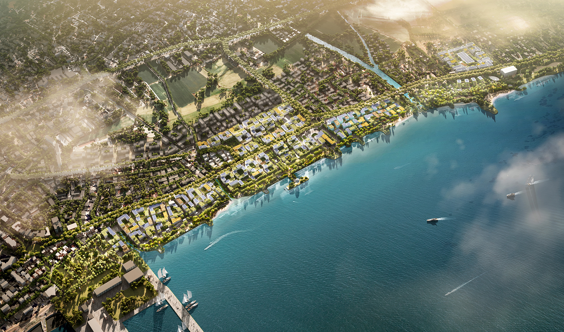
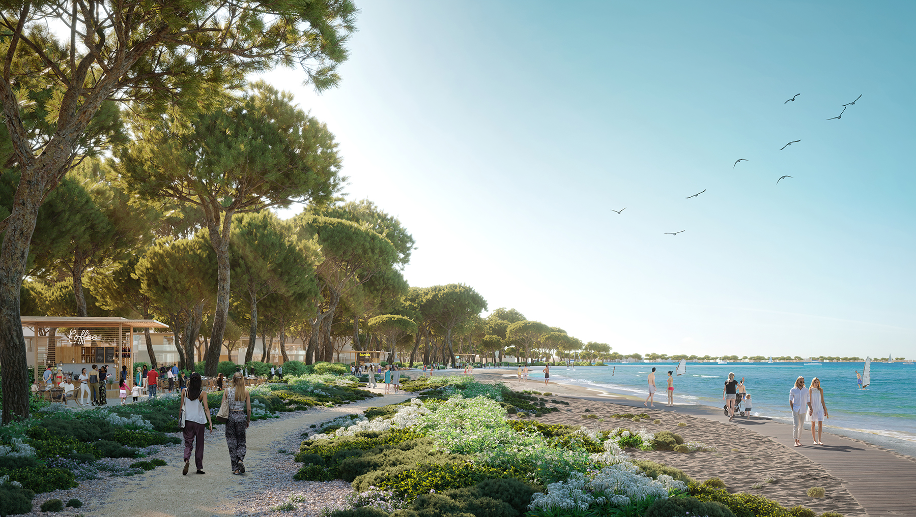
Development will straddle 2.5 km of Larnaca-Dhekelia Road, which follows the coast from Larnaca to the British Overseas Territory of Dhekelia. The plan roughly doubles the existing 2.5 km of waterfront available to the public.
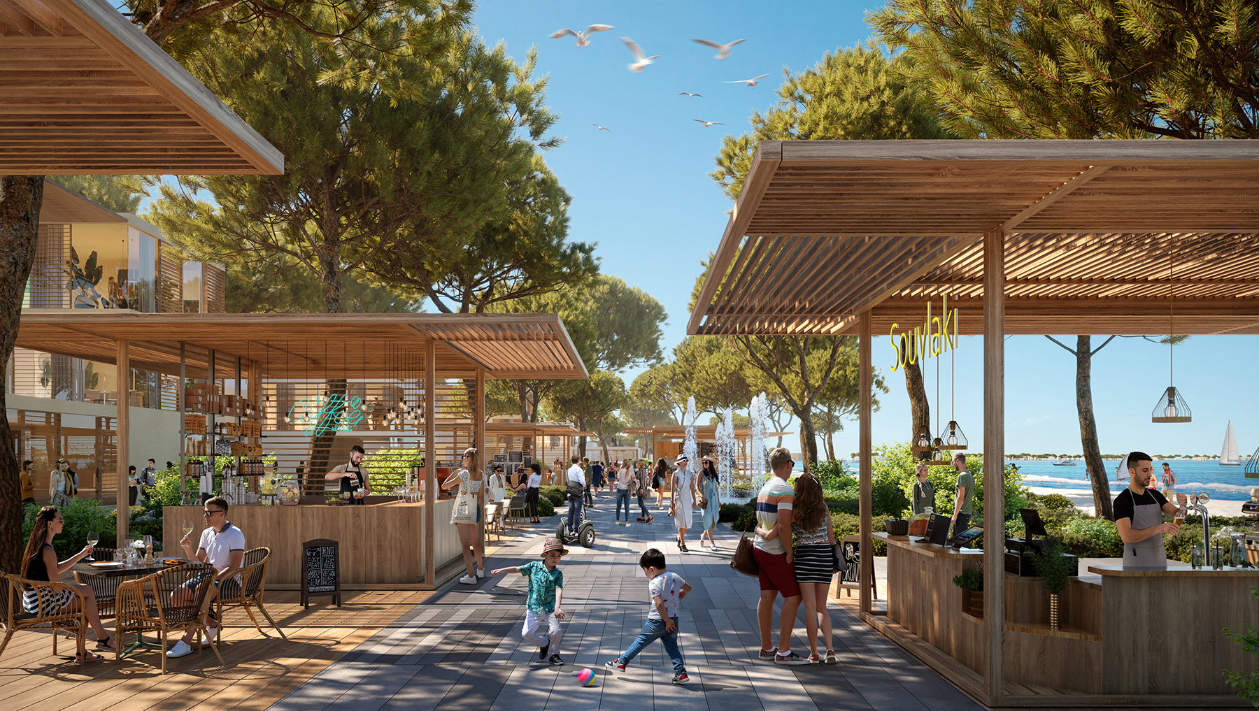
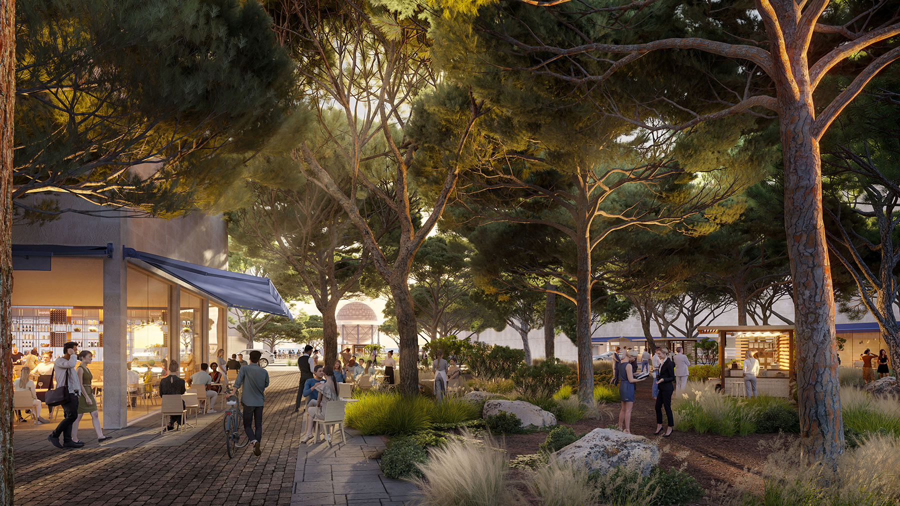
“The master plan is conceived as a natural extension to the city with a new mixed-use development for people to live, work, and relax in,” says Ben Scott, a senior partner at Foster + Partners. “Publicly accessible amenities such as shops, cafes, and restaurants — and an extensive cultural program — create a sense of community and will be designed to celebrate the industrial heritage of the area.”
In addition to the highway, the master plan aims to restore the area’s three main waterways and coastal sand dune systems, continues Scott.
Natural riverbed materials will replace existing concrete in the city’s canals, while natural bank materials and new plantings will also be added where possible in an effort to allow natural processes to return.
Larnaca — the capital of the Larnaca District — sits on the island’s southeast coast near the Cyprus Buffer Zone, the demilitarized zone established by the United Nations Peacekeeping Force in 1974 as part of the cease-fire between Greek Cypriots to the south and Turkish Cypriots to the north. The zone stretches approximately 180 km across the island and divides Cyprus in two. Devoid of humans, it has inadvertently served for the past five decades as a shelter for natural ecosystems, including endangered flora and fauna, according to a 2014 technical report spearheaded by the University of Cyprus and submitted to the International Partnership for the Satoyama Initiative.
Mindful of the buffer zone, the seafront master plan aims to connect the inland environment with the coast using blue-green corridors, says Scott. A network of green streets linking squares and courtyards will cover the master plan zone.
The plan will also build up coastal habitats by restoring the coastal dune systems.
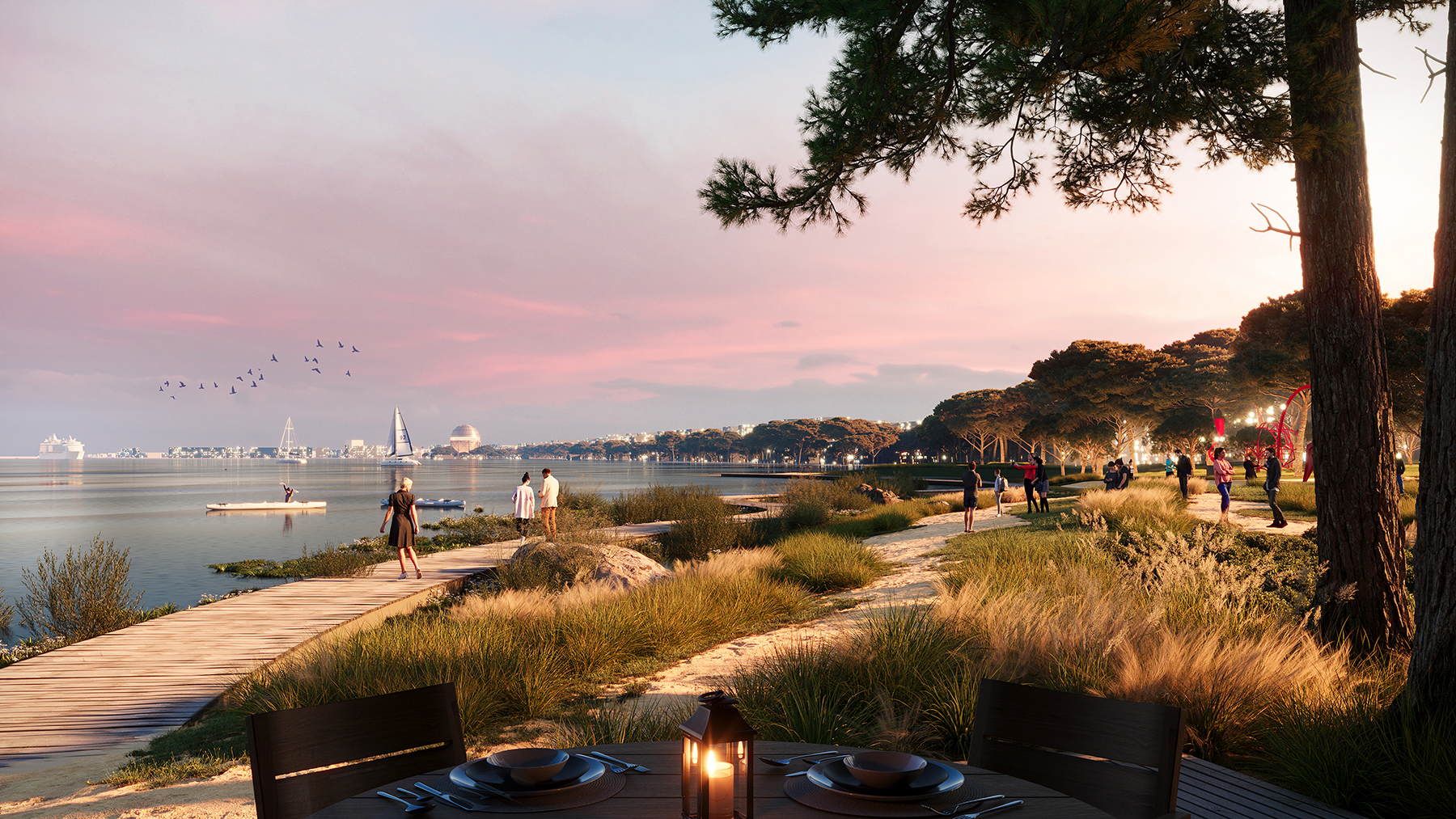
“Reconnecting the natural landscape with the wider area is important for increasing the resilience and quality of ecosystems and creates new habitats for wildlife in Cyprus,” Scott says. The restored areas will assist with flood control and coastal erosion and provide natural areas to explore without leaving the city.
Meanwhile, new developments will be “sensitively located between the enhanced ecological zones that connect inland areas to the coastline,” according to written press material from Foster + Partners. These low-rise additions will also celebrate the city’s industrial heritage through their architecture and use of repurposed industrial artifacts.
The master plan will be submitted for planning early this summer, with further design work beginning once that permit is granted, says Scott. Construction will start “as soon as possible thereafter.”
This article first appeared in Civil Engineering Online.